The Natural Springs of Los Haitises National Park: Groundwater Discharge, Limestone Geology and Wetland Connections
Introduction
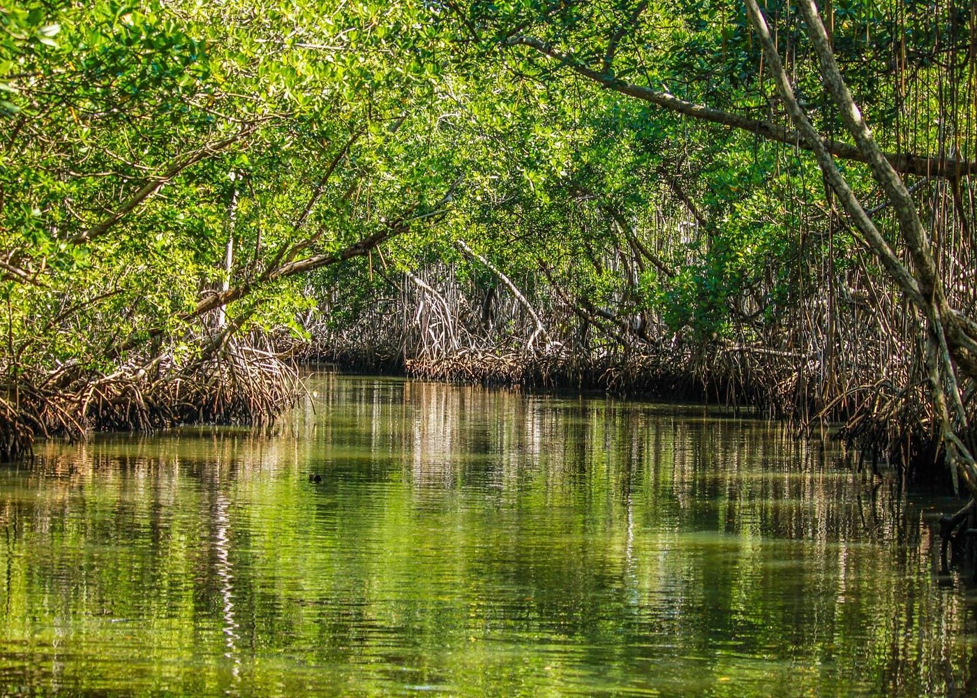
Los Haitises National Park is known for its mangroves, limestone hills, caves, coastal islands and extensive wetlands. Beneath this landscape, another natural process helps shape the environment: groundwater emerging from the ground through natural springs.
A spring forms when underground water reaches the Earth's surface. In a limestone region such as Los Haitises, this can happen through fractures, cavities and underground channels developed by the gradual dissolution of rock.
Natural springs are important because they connect underground water with visible surface environments. Depending on their location, they may contribute water to streams, low-lying areas and wetlands. In coastal karst environments, groundwater can also emerge beneath the sea.
Scientific research has investigated springs, rivers and wells throughout the wider Los Haitises hydrogeological region. Researchers have measured water levels and analyzed water chemistry and natural isotopes to better understand how groundwater interacts with wetlands and surface-water systems.
This guide explains how natural springs form, why they are important to the landscape and what their presence tells us about the water system of Los Haitises.
1. What Is a Natural Spring?
A natural spring is a place where groundwater flows or seeps naturally onto the Earth's surface.
Groundwater exists below the surface in soil, sediment and rock formations. It moves through spaces between particles, fractures and larger underground openings. When the water reaches an outlet where the land surface intersects the groundwater system, a spring may form.
Some springs produce a visible stream. Others release water slowly through damp ground, rock openings or the bottom of a wetland.
A spring does not always look like a dramatic fountain or waterfall. In a tropical landscape, it may appear as a small flow emerging from beneath vegetation or limestone.
The main characteristic is that the water comes from an underground source rather than being supplied only by direct rainfall at that location.
In Los Haitises, natural springs are part of the wider karst hydrological environment, where limestone geology influences how groundwater moves and reaches the surface.
2. Why Natural Springs Form in Los Haitises
The geology of Los Haitises creates conditions that allow groundwater to move through limestone.
Much of the wider region consists of carbonate rocks that have experienced extensive karst development. Rainwater can gradually dissolve limestone, creating openings that become part of an underground drainage system.
Several geological features help explain spring formation:
Limestone fractures: Natural cracks and joints allow water to enter the rock and move underground.
Cavities and conduits: Dissolution creates underground spaces that can transport groundwater.
Dolines: Closed depressions may collect rainfall and allow water to enter the karst system.
Rock boundaries: Changes between geological materials can influence where groundwater moves or emerges.
Underground passages: Larger openings may carry water toward natural discharge points.
When groundwater encounters an opening connected to the land surface, it can emerge as a spring.
The Dominican Republic's National Geological Service describes the Los Haitises hydrogeological unit as a region with advanced karst development. Its geological characteristics strongly influence groundwater recharge, movement and discharge.
3. How a Natural Spring Develops
Natural springs develop through a combination of rainfall, underground water movement and geological conditions.
The process can be explained in five stages.
Stage 1: Rainfall replenishes the ground
Rain falls over forests, limestone hills, exposed rock and other surfaces. Some water runs across the ground, while some infiltrates the soil and enters openings in the limestone.
Stage 2: Water enters the karst formation
Water moves through fractures, joints, depressions and other openings. In some locations, it can enter larger underground cavities.
Stage 3: Groundwater travels through the rock
Below the surface, water follows available pathways. The routes depend on the arrangement of the limestone, the size of openings and the surrounding geological structure.
Stage 4: Water reaches a natural outlet
Groundwater may encounter a hillside, valley, stream channel or geological boundary that allows it to reach the surface.
Stage 5: A spring contributes water to the environment
Water emerges naturally and may form a small stream, feed a wetland or join another surface-water system.
Not every spring follows exactly the same pathway. Some are supplied by relatively shallow groundwater, while others are connected to deeper karst drainage routes.
4. Different Types of Springs in a Karst Landscape
Springs can occur in several geological and hydrological settings. The National Geological Service's hydrogeological study of the Los Haitises unit describes different relationships between spring outlets and surface-water levels.
Springs above surface-water levels
Some springs emerge at elevations above nearby rivers or streams. Their water can travel downhill through natural channels before joining a larger watercourse.
These outlets can be associated with hillsides, slopes or elevated geological boundaries.
Springs at the level of surface channels
Other springs emerge at approximately the same level as nearby streams or drainage channels.
Their water may join the existing channel almost immediately, making the spring difficult to distinguish from the surrounding flow.
Springs below streambeds
Groundwater may also discharge below the level of a surface-water channel.
In these situations, the outlet may be less visible because the groundwater enters the channel from below or through the underlying materials.
Submarine springs
In coastal karst environments, groundwater can sometimes travel toward the sea and emerge underwater.
These outlets are known as submarine springs. They are not ordinary freshwater springs beside a stream; they occur below the marine surface.
The hydrogeological study of the wider Los Haitises unit identifies submarine groundwater outlets along part of its northern coastal margin.
These categories help explain the variety of groundwater discharge environments in the region. They should not be interpreted as a list of individually named visitor attractions.
5. The Relationship Between Limestone and Spring Water
Limestone is one of the most important geological materials influencing the formation of springs in Los Haitises.
Unlike many relatively impermeable rocks, karstified limestone can contain interconnected openings. Water may move through small fractures as well as larger cavities and conduits.
This creates a drainage system that can be difficult to understand from the surface.
The gradual dissolution of limestone can enlarge existing cracks. Over long periods, some openings develop into substantial underground passages.
The resulting network affects where water travels and where it eventually emerges.
However, not every limestone opening becomes a spring. A spring requires a connection between groundwater and a natural outlet at the surface or beneath a body of water.
The location and flow of a spring depend on the underground structure, groundwater level and available discharge routes.
6. Natural Springs and the Wetlands of Los Haitises
One of the most important ecological relationships in Los Haitises is the connection between groundwater and wetlands.
The park and its wider surroundings contain wetlands within a karst environment. These habitats include waterlogged areas and other low-lying environments whose water conditions are influenced by rainfall, surface drainage and groundwater.
A spring can contribute water to a wetland when its outlet is located nearby or when the groundwater system discharges directly into the wetland environment.
This connection matters because wetland water levels influence the conditions experienced by aquatic plants, wetland vegetation and animals.
Research published in 2013, titled Humedales en Los Haitises, República Dominicana, investigated the hydrogeological characteristics of the region and described numerous wetlands linked to groundwater.
The researchers measured water levels in rivers, springs and wells and collected samples for chemical and isotopic analysis.
Their work provides scientific evidence that springs and groundwater should be considered when understanding the wetland system of Los Haitises.
It does not mean that every wetland receives water from a visible spring. Different wetlands can have different combinations of rainfall, surface-water and groundwater inputs.
7. How Springs Connect With Rivers and Surface Water
Natural springs can create a connection between underground water and visible rivers.
When groundwater emerges from a spring, it may form a small stream that flows downhill. That stream can eventually join a larger river or drainage channel.
In other locations, groundwater may enter an existing watercourse without forming a separate visible stream.
This relationship is important in karst landscapes because the underground and surface drainage systems do not always operate independently.
A river may receive groundwater from springs, while some surface water may enter the limestone and become part of the underground system.
The direction and strength of these connections depend on local geology and water levels.
For visitors, this means that the visible rivers and wetlands of Los Haitises represent only part of the wider hydrological system.
8. Are There Springs Beneath the Sea Near Los Haitises?
Groundwater discharge does not always happen on land.
In coastal limestone regions, underground water can continue moving toward the coastline. Where an underground pathway reaches the seabed, groundwater may emerge underwater.
This is called submarine groundwater discharge.
The National Geological Service's hydrogeological study identifies submarine spring outlets along the northern coastal margin of part of the wider Los Haitises hydrogeological unit.
This is a significant feature of coastal karst hydrology because it demonstrates that groundwater pathways can extend toward marine environments.
Submarine springs are generally harder to observe than springs on land. Their identification may require specialized fieldwork, water measurements and hydrogeological investigation.
It is important not to assume that every mangrove channel, coastal cave or bay contains a confirmed submarine spring. The scientific report identifies discharge within the wider hydrogeological unit, not a spring at every coastal location.
9. What Does Spring Water Tell Scientists?
Natural springs provide valuable information about underground water systems.
Scientists can collect spring water and compare its properties with water from rivers, wells and other sources.
Several methods help researchers understand these relationships.
Water-level measurements
Measuring the water level at springs and nearby water bodies helps researchers understand changes in groundwater discharge and the relationship between underground and surface water.
Chemical analysis
Water chemistry can reveal information about dissolved minerals and the geological materials through which water has travelled.
Isotope analysis
Naturally occurring isotopes in water can help scientists investigate water sources and hydrological processes.
Flow observations
Monitoring the amount of water emerging from a spring can help researchers understand how discharge changes under different environmental conditions.
Comparing different water sources
Scientists can compare samples from springs, rivers, wells and wetlands to identify similarities and differences.
The 2013 Los Haitises wetland study used water-level measurements and hydrochemical and isotopic sampling. It reported similarities between the isotopic characteristics of spring water and groundwater samples, supporting the interpretation that these water bodies are connected within the regional hydrological system.
Such research helps develop a more complete picture of the region's water resources.
10. Does Spring Flow Change During the Year?
Spring flow can change in response to rainfall and groundwater conditions.
When more water enters the ground, groundwater levels may rise and discharge from some springs may increase. During drier periods, some springs may experience reduced flow.
However, the response depends on the characteristics of the individual spring.
A spring connected to a large underground storage system may respond differently from one supplied by a smaller or more shallow groundwater source.
In karst regions, some underground passages can transmit water relatively quickly, while other parts of the system store water for longer periods.
This means that not all springs respond to rainfall at the same speed.
Although seasonal changes are a reasonable hydrological consideration, visitors should not assume that a particular spring in Los Haitises has a predictable seasonal flow pattern without location-specific monitoring data.
11. Why Natural Springs Matter for Biodiversity
Natural springs can create localized environments with different moisture and water conditions from the surrounding landscape.
Where a spring supplies freshwater to a wetland or stream, it can contribute to habitats used by aquatic organisms, wetland plants and other wildlife.
The ecological importance of a spring depends on its water quality, flow, location and connection with nearby habitats.
Potential ecological roles include:
- Providing water to nearby wetland environments.
- Supporting small surface-water channels.
- Maintaining moist conditions in selected habitats.
- Connecting groundwater with surface ecosystems.
- Contributing to the wider water balance of the landscape.
The importance of springs should not be separated from the wider conservation of Los Haitises. Their condition is connected to the quality of the groundwater system and the health of the surrounding environment.
12. Threats to Natural Springs and Groundwater Quality
Although natural springs are part of the landscape, they can be affected by environmental pressures.
Because karst limestone contains openings that allow water to move underground, contaminants entering the ground may reach groundwater pathways.
Potential threats include:
Waste disposal: Rubbish and improperly discarded materials can contaminate soil and water.
Chemical pollution: Certain chemicals may enter groundwater through infiltration or drainage.
Soil disturbance: Land disturbance can change runoff and increase sediment movement into water environments.
Vegetation removal: Changes in vegetation and soil cover can influence how rainfall reaches the ground and how surface water moves.
Uncontrolled access: Careless activity around spring outlets and wetland edges can damage sensitive natural areas.
Protecting springs therefore requires attention not only to the outlet itself but also to the surrounding land and the groundwater recharge area.
A spring can be affected by activities occurring some distance away if those activities are hydrologically connected to its underground source.
13. How Visitors Can Help Protect Natural Springs
Visitors do not need to enter a spring or touch the water to appreciate its importance.
Responsible behavior can help protect the natural water system of Los Haitises.
Follow these simple practices:
- Never throw rubbish into streams, wetlands, caves or natural openings.
- Do not pour soaps, oils or chemicals into natural water.
- Stay on authorized visitor routes.
- Follow the instructions of park authorities and authorized guides.
- Avoid disturbing vegetation around water outlets.
- Do not collect rocks, plants or other natural materials.
- Do not enter restricted cave passages or attempt to explore underground water routes independently.
If a spring or water outlet is not included in an authorized visitor route, respect the access restrictions.
Protecting natural water sources is part of protecting the entire park ecosystem.
14. Can Tourists Visit Natural Springs in Los Haitises?
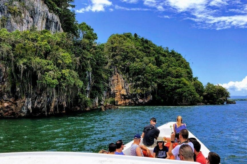
Los Haitises offers opportunities to experience its natural landscape through authorized excursions, including boat trips through mangrove channels and visits to selected attractions.
However, the existence of natural springs in the wider hydrogeological region does not mean that they are all accessible to visitors.
A standard boat tour should not be advertised as a natural-spring excursion unless the operator confirms that a specific spring is included and that access is permitted.
Travelers interested in the park's water environments can ask tour operators about the waterways, wetlands and natural features included in their itinerary.
Before booking, confirm the actual stops, duration, transportation arrangements and current access conditions.
The best way to experience Los Haitises is through an authorized excursion that respects the park's environmental rules.
Conclusion
Natural springs are an important part of the water system of Los Haitises. They form where groundwater moving through limestone and other geological openings reaches the surface or emerges beneath coastal waters.
Their importance extends beyond the water visible at the outlet. Springs connect groundwater with rivers, wetlands and other parts of the landscape.
Scientific studies of the wider Los Haitises region have examined springs through water-level measurements, chemical analysis and isotope research. These investigations have helped explain the relationship between groundwater and the region's wetlands.
For conservation, protecting natural springs means protecting the wider groundwater system and the environments connected to it.
The next time you explore the mangroves, limestone hills and wetlands of Los Haitises, remember that some of the water supporting this landscape may have travelled underground before returning to the surface.
Frequently Asked Questions
1. What is a natural spring?
A natural spring is a place where groundwater emerges naturally onto the Earth's surface or, in coastal environments, beneath the sea.
2. Why are there natural springs in Los Haitises?
The wider Los Haitises region has extensive karstified limestone. Fractures, cavities and underground passages allow groundwater to move and emerge through natural outlets.
3. Are natural springs connected to limestone caves?
Some springs can be connected to underground passages and cavities in limestone. However, the connection must be established for each location rather than assumed.
4. Do springs supply water to Los Haitises wetlands?
Groundwater is linked to numerous wetlands in the Los Haitises karst environment. Springs can contribute water to wetland environments, although the importance of each spring varies by location.
5. What is a submarine spring?
A submarine spring is a natural underwater outlet where groundwater emerges into the sea. The regional hydrogeological study identifies submarine groundwater outlets along part of the northern coastal margin of the wider Los Haitises unit.
6. Does spring water flow throughout the year?
Some springs may have relatively steady discharge, while others respond more strongly to rainfall and seasonal groundwater changes. The behavior depends on the individual spring and its underground source.
7. Is natural spring water safe to drink?
Not automatically. Natural water can contain microorganisms or dissolved substances. It should not be considered safe for drinking without appropriate testing and treatment.
8. How do scientists study springs?
Scientists use water-level measurements, flow observations, chemical analysis and isotope analysis to understand spring water and its relationship with groundwater, rivers and wetlands.
9. Can tourists visit natural springs in Los Haitises?
Some natural water features may be accessible through authorized excursions, but visitors should confirm specific stops and permissions with their tour operator or park authorities.
10. Why should natural springs be protected?
Springs connect underground water with surface ecosystems. Protecting them helps maintain groundwater quality and supports the wider wetland and freshwater environment.
Local explorer & expert guide in El Limón Waterfall.