Los Haitises National Park Geography: Bays, Islands & Karsts (2027)
The Dominican Republic is home to some of the Caribbean's most remarkable natural landscapes, but few destinations offer a combination of coastal scenery, limestone formations, mangrove forests, and tropical waterways quite like Los Haitises National Park.
Located in the northeastern part of the Dominican Republic, near Samaná Bay and Sabana de la Mar, Los Haitises is famous for its unusual geographical features. Its landscape includes steep limestone hills known as mogotes, sheltered coastal bays, small islands and cays, extensive mangrove forests, caves, and forest-covered terrain.
The geography of Los Haitises is especially interesting because land and water are closely connected. Limestone formations rise above coastal waters, mangrove roots extend into sheltered channels, and forest vegetation covers much of the surrounding landscape.
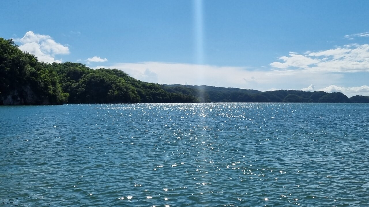
One of the most recognizable areas is San Lorenzo Bay, where visitors can admire limestone formations emerging from the water and mangrove vegetation along the coast.
Whether you are interested in geology, photography, nature, or travel, understanding the geography of Los Haitises can help you appreciate what makes this national park so distinctive.
In this guide, we explore the geographical location of Los Haitises, its limestone karst formations, bays, islands, mangrove channels, caves, and the best ways to experience its remarkable natural landscape.
1. Where Is Los Haitises National Park Located?
Los Haitises National Park is situated in the northeastern Dominican Republic, along the southwestern side of Samaná Bay.
The protected area is associated with several surrounding provinces and communities, including areas near Sabana de la Mar and Samaná.
Its geographical position gives it a distinctive combination of coastal, forest, wetland, and limestone environments.
The park is particularly recognized for its karst landscape and mangrove forests, which are among its most important natural characteristics.
Its Position Near Samaná Bay
Samaná Bay is an important geographical feature of northeastern Dominican Republic. Los Haitises lies along its southern and southwestern surroundings.
The relationship between the bay and the park creates a landscape where coastal waters meet limestone formations, mangrove forests, and tropical vegetation.
This geographical connection is one reason boat excursions are popular among visitors.
Nearby Communities
Sabana de la Mar is one of the important communities associated with access to Los Haitises.
Samaná is another well-known starting area for excursions around the bay and the national park.
These communities help connect visitors with the region's natural attractions through local transportation and guided tourism services.
2. Understanding the Karst Geography of Los Haitises
One of the most important geographical characteristics of Los Haitises is its extensive tropical karst landscape.
Karst is a type of terrain formed when water gradually dissolves soluble rocks, especially limestone. Over long periods, this process creates distinctive geological features such as caves, depressions, valleys, underground drainage systems, and steep hills.
Los Haitises is particularly famous for its limestone formations and mogotes.
How Is a Karst Landscape Formed?
The formation of karst landscapes takes place over long geological periods.
Rainwater absorbs carbon dioxide from the atmosphere and soil, becoming slightly acidic. As it moves over and through limestone, it gradually dissolves parts of the rock.
Over time, this process can create:
- Natural caves
- Underground cavities
- Limestone hills
- Surface depressions
- Narrow valleys
- Irregular rocky formations
- Underground water pathways
These features contribute to the distinctive geography of Los Haitises.
Why Is the Karst Landscape Important?
The karst landscape influences the appearance of the park and the way water moves through its terrain.
It also creates different habitats for plants and animals.
For visitors, the formations provide some of the most recognizable scenery in the Dominican Republic.
3. What Are the Mogotes of Los Haitises?
The mogotes are among the most recognizable geological features of Los Haitises.
Mogotes are steep-sided, rounded or irregular limestone hills that rise above the surrounding terrain. In Los Haitises, many are covered with tropical vegetation, giving them a green appearance.
Some formations are located close to the coast, where they create dramatic views from the water.
How Do Mogotes Form?
Mogotes develop through long-term limestone dissolution and erosion.
As water gradually changes the surrounding limestone terrain, some areas remain as raised rock formations while other parts become depressions and valleys.
This process produces the distinctive hills seen throughout the region.
What Makes Los Haitises Mogotes Special?
The mogotes are especially interesting because they appear alongside mangrove forests, coastal waterways, and small islands.
Their steep shapes create a landscape that looks very different from the wide sandy beaches commonly associated with the Dominican Republic.
Best Way to See the Mogotes
A boat excursion is one of the popular ways to observe the coastal limestone formations.
Traveling through selected waterways allows visitors to appreciate how the mogotes rise above the surrounding water and vegetation.
Visitors should follow the operator's route and avoid entering restricted areas.
4. San Lorenzo Bay: One of the Most Distinctive Coastal Areas
San Lorenzo Bay is one of the important geographical features associated with Los Haitises National Park.
It is a coastal inlet along the southern side of Samaná Bay, within the park area.
The bay is known for its combination of limestone mogotes, mangrove-covered coastlines, small rocky islands, and natural waterways.
Limestone Formations Rising from the Water
One of the most recognizable sights around San Lorenzo Bay is the presence of limestone formations emerging from the water.
These formations create a distinctive coastal landscape where rock, vegetation, and water meet.
Their unusual shapes make the area particularly interesting for photography and nature observation.
Mangroves Along the Coast
Mangrove vegetation forms an important part of the bay's coastal environment.
The roots of mangrove trees extend into shallow water, creating habitats for different aquatic organisms and coastal wildlife.
The vegetation also contributes to shoreline stability and ecological protection.
Why Is San Lorenzo Bay Important?
San Lorenzo Bay is important for several reasons:
- It is part of the protected landscape of Los Haitises.
- It contains distinctive limestone coastal formations.
- Mangrove vegetation supports local biodiversity.
- It is associated with caves containing archaeological features.
- It offers opportunities for guided boat exploration.
Exploring San Lorenzo Bay by Boat
Boat travel is a common way to experience the bay.
Visitors can admire the limestone scenery, mangrove vegetation, and coastal landscape from the water.
The actual route and visitor stops depend on the tour operator and current park regulations.
5. Islands and Cays of Los Haitises
The coastal landscape of Los Haitises includes small islands, rocky outcrops, and cays.
These geographical features are closely connected with the park's limestone terrain and coastal environment.
A cay is a small, low-lying island, often associated with tropical coastal waters.
How Are the Islands Formed?
Some of the small islands and rocky formations around Los Haitises are associated with the region's limestone geology.
Over geological time, erosion and natural changes in the coastal landscape have contributed to the formation of isolated rock areas and land surrounded by water.
The result is a coastal environment with numerous small formations and sheltered waterways.
Why Are the Cays Important?
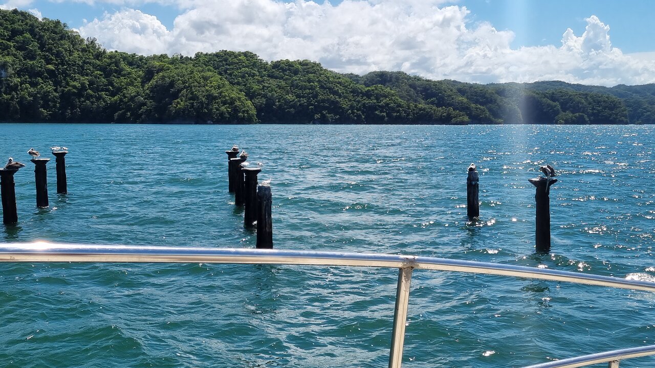
Small islands and cays provide habitats for different bird species.
Some are important resting or nesting areas for coastal birds.
The vegetation and surrounding waters also contribute to the wider ecological environment of the park.
Cayo de los Pájaros
Cayo de los Pájaros is a recognized natural attraction associated with the San Lorenzo Bay area.
Its importance is connected with birdlife, including species that use coastal islands for resting and nesting.
Visitors should observe birds from a respectful distance and avoid disturbing sensitive habitats.
Can Visitors Explore the Islands?
Some boat excursions travel through areas where visitors can view islands and coastal formations.
However, landing on every island is not necessarily permitted.
Access depends on park rules, wildlife protection requirements, and the tour itinerary.
6. The Mangrove Geography of Los Haitises
Mangrove forests are among the most important components of Los Haitises' coastal geography.
They grow along sheltered shorelines, shallow coastal waters, and protected channels.
Their presence creates a natural connection between the land and the surrounding aquatic environment.
What Are Mangroves?
Mangroves are salt-tolerant trees and shrubs that grow in tropical and subtropical coastal environments.
Unlike many ordinary trees, mangroves are adapted to waterlogged soils and changing salinity conditions.
Their root systems help them survive in environments where land and water meet.
Mangrove Channels
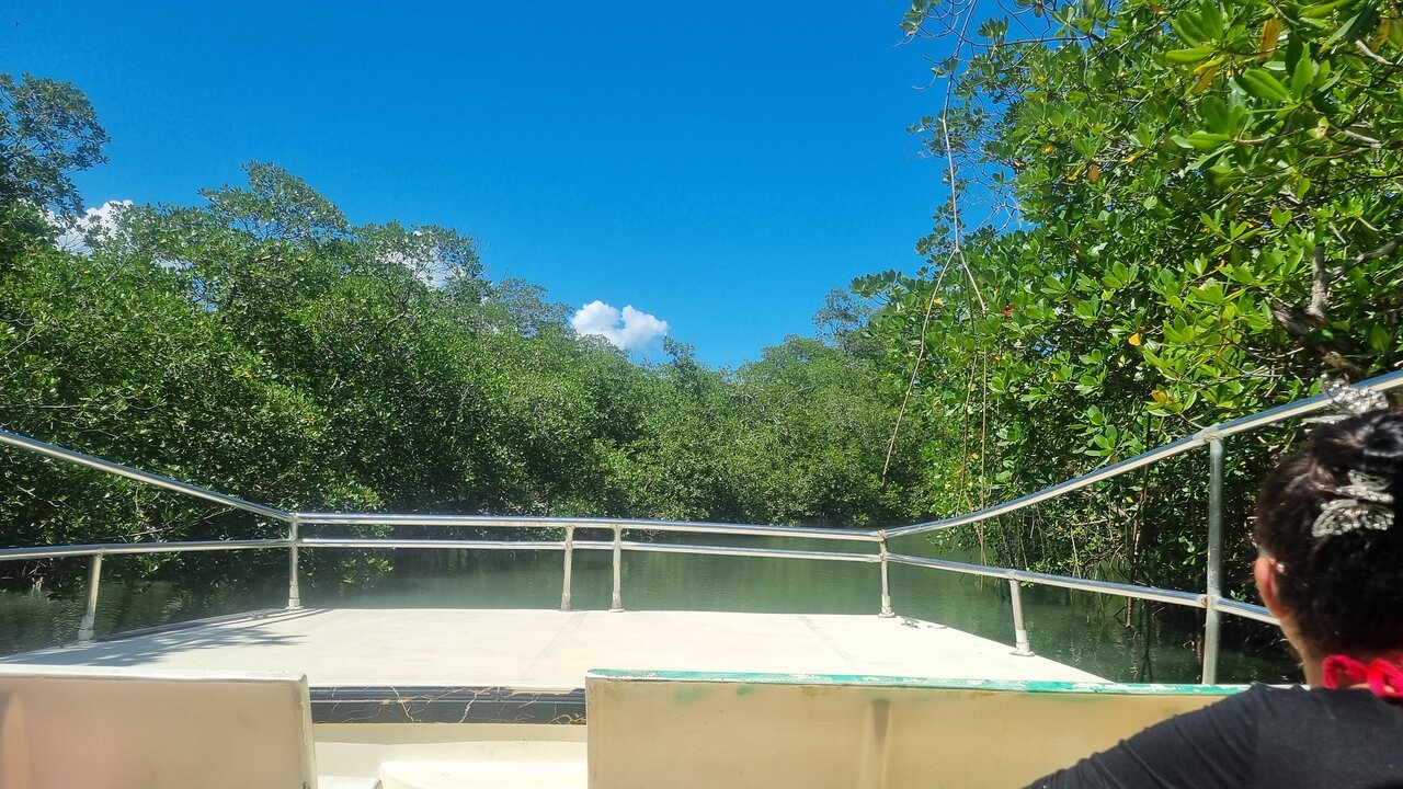
The park contains waterways surrounded by mangrove vegetation.
These channels are among the most recognizable features of a Los Haitises boat excursion.
Visitors can travel through selected routes and observe the vegetation from the water.
Importance of Mangrove Roots
Mangrove roots provide important environmental functions.
They help:
- Stabilize coastal soil
- Reduce shoreline erosion
- Provide habitats for aquatic organisms
- Create nursery areas for fish and other species
- Support coastal biodiversity
- Store carbon in vegetation and soils
Why Are the Mangroves Important to the Park's Geography?
The mangroves are not simply decorative vegetation.
They are an essential part of the coastal environment and influence how water, wildlife, and vegetation interact throughout the park.
Their relationship with limestone formations and coastal islands gives Los Haitises its distinctive appearance.
7. Rivers, Waterways, and Coastal Connections
Water is a major geographical element of Los Haitises.
The park's coastal environment includes bays, channels, mangrove waterways, and connections with surrounding freshwater systems.
These water features influence the distribution of vegetation and wildlife throughout the region.
Coastal Waterways
Coastal waterways provide routes through the mangrove environment and connect different parts of the landscape.
Boat excursions allow visitors to explore selected waterways while observing the surrounding vegetation and geological formations.
Connection with Samaná Bay
The park's coastal geography is closely connected with Samaná Bay.
This connection creates a mixture of sheltered coastal environments and open-water scenery.
It also helps explain why boat excursions are an important part of tourism in the area.
Why Water Matters to the Ecosystem
Water supports mangrove growth, aquatic habitats, and the movement of nutrients through coastal environments.
The relationship between freshwater, coastal water, vegetation, and limestone terrain contributes to the ecological importance of Los Haitises.
8. Caves and Underground Geological Features
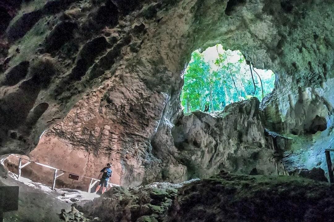
The limestone geology of Los Haitises has contributed to the formation of numerous caves and underground cavities.
These caves are important both geologically and culturally.
Some contain evidence of Indigenous Taíno activity, including pictographs and petroglyphs.
How Do Limestone Caves Form?
Limestone caves develop when slightly acidic water gradually dissolves rock.
As water moves through cracks and openings, it can enlarge them into underground passages and cavities.
Over time, these spaces may become extensive cave systems.
Caves Associated with Los Haitises
Several caves are recognized as sites of interest in the park, including:
- Cueva de la Arena
- Cueva de San Gabriel
- Cueva de la Línea
The exact attractions included in a visitor excursion depend on current access arrangements.
Taíno Rock Art
Some caves contain pictographs and petroglyphs associated with the Indigenous Taíno people.
These features give the caves cultural and historical importance beyond their geological value.
Visitors should never touch or damage rock art.
Important Visitor Access Information
Cave access can change because of conservation, maintenance, or safety restrictions.
Cueva de la Línea was temporarily closed through an announcement by the Dominican Ministry of Environment in June 2026 due to deterioration of its access dock.
Before booking a tour, confirm the current status of each cave you want to visit.
9. The Relationship Between Forests and Limestone Terrain
Although Los Haitises is widely known for its coastal scenery, forests are another important part of its geography.
Tropical vegetation covers many limestone formations and surrounding areas.
This creates a landscape where green forest can be seen growing across steep hills, rocky surfaces, and sheltered valleys.
Humid Tropical Forest
The park includes humid forest environments that support diverse vegetation.
These areas provide habitats for numerous species and contribute to the region's natural biodiversity.
Vegetation on Mogotes
Many limestone hills are covered with vegetation.
Plants grow across the rock surfaces and contribute to the green appearance of the formations.
The combination of limestone and forest creates a distinctive landscape.
Why Forest Cover Matters
Forest vegetation helps maintain ecological processes, provides wildlife habitats, and contributes to the natural balance of the protected area.
It is also one of the reasons the park appears so different from the drier coastal landscapes found elsewhere in the Dominican Republic.
10. How the Geography of Los Haitises Supports Wildlife
The different geographical features of Los Haitises create a variety of habitats.
Mangroves, forest areas, caves, wetlands, small islands, and coastal waters all contribute to the park's biodiversity.
Bird Habitats
The coastal islands, mangroves, and forests provide habitats for numerous bird species.
Visitors may observe pelicans, herons, egrets, and other birds depending on the location and season.
Aquatic Habitats
Mangrove roots and coastal waters support aquatic organisms and provide nursery environments for some species.
These habitats are important parts of the wider coastal ecosystem.
Forest Wildlife
Forest environments provide shelter and food for different animals.
The park's geographical diversity helps support a range of species with different habitat requirements.
Responsible Wildlife Observation
Visitors should avoid feeding animals, making unnecessary noise, or approaching sensitive nesting areas.
Observing wildlife from a respectful distance helps protect the natural environment.
11. How to Experience the Geography of Los Haitises
The best way to understand the geography of Los Haitises is to experience its different natural environments.
A guided excursion can help visitors appreciate the relationship between the limestone formations, mangroves, coastal waterways, and surrounding vegetation.
Boat Exploration
Boat excursions are among the most popular ways to explore selected coastal areas.
They provide opportunities to view limestone mogotes, mangrove channels, islands, and coastal scenery.
Nature Observation
Visitors can observe the vegetation, wildlife, and geological formations while traveling through the park.
A local guide may explain how the landscape developed and why its ecosystems are important.
Cave Visits
Some excursions include authorized cave visits.
These experiences can provide insight into the park's geological features and Indigenous cultural heritage.
Always confirm current access conditions before booking.
Photography
The contrast between green vegetation, limestone formations, and coastal water makes Los Haitises an interesting destination for landscape photography.
Visitors should protect their equipment from water and follow all park regulations.
12. Best Places to See the Geography of Los Haitises
Several locations and natural features are associated with the park's distinctive landscape.
San Lorenzo Bay
San Lorenzo Bay is particularly interesting for its coastal limestone formations, mangroves, and small islands.
It is one of the most recognizable areas for appreciating the relationship between land and water.
Caño Hondo
Caño Hondo is a recognized point of interest associated with Los Haitises.
It is connected with the park's natural environment and visitor activities.
Caño Salado
Caño Salado is another location listed among the park's sites of interest.
Its importance is connected with the wider landscape of waterways and natural habitats.
Cayo de los Pájaros
This cay is associated with birdlife and coastal habitats.
It is a notable feature of the park's island and coastal geography.
Los Naranjos
Los Naranjos is also identified as a site of interest in the official park information.
Visitors should check which areas are included in their selected excursion.
13. Why the Geography of Los Haitises Is Important for Conservation
The geography of Los Haitises is not only visually impressive. It also supports important ecological processes.
The relationship between limestone terrain, forests, wetlands, mangroves, and coastal waters makes the park an important protected natural area.
Protecting Limestone Formations
The mogotes, caves, and other karst features developed over long geological periods.
Damaging these formations can permanently affect the natural landscape.
Protecting Mangrove Forests
Mangroves provide habitats for wildlife and help protect coastal environments.
Protecting them is essential for maintaining the ecological health of the region.
Protecting Islands and Bird Habitats
Small islands and cays may provide important resting and nesting areas for birds.
Human disturbance can affect sensitive wildlife habitats.
Protecting Archaeological Resources
The caves and rock art associated with Taíno heritage are important cultural resources.
They should be protected from vandalism and unnecessary contact.
Responsible Tourism
Visitors can contribute to conservation by following park rules, avoiding littering, respecting wildlife, and using authorized routes and services.
14. Best Time to Explore the Natural Landscape
Los Haitises has a tropical climate, with warm temperatures and the possibility of rainfall throughout the year.
Weather conditions can influence boat excursions and other outdoor activities.
Check Weather Conditions
Rain, wind, and water conditions may affect the planned route or the availability of certain activities.
Check the forecast before your visit and follow the tour operator's instructions.
Choose a Suitable Tour
Different excursions may explore different areas of the park.
If your main interest is limestone formations and coastal scenery, ask whether the route includes San Lorenzo Bay or other relevant locations.
Confirm Attraction Access
Some visitor sites may be temporarily unavailable.
Confirm the current access conditions for caves, docks, and other attractions before traveling.
15. What Should You Bring for a Geography and Nature Tour?
A few basic items can make your visit more comfortable.
Recommended items include:
- Lightweight and comfortable clothing
- Suitable footwear
- Hat or cap
- Sunglasses
- Sunscreen
- Drinking water
- Camera or smartphone
- Waterproof pouch
- Insect repellent
- Small personal bag
If your excursion includes walking or cave visits, ask the operator about any additional footwear or clothing recommendations.
Keep your personal belongings secure and follow the guide's safety instructions.
16. Is Los Haitises Worth Visiting for Its Geography?
Yes, Los Haitises is a particularly interesting destination for travelers who enjoy natural landscapes and geographical features.
Its combination of limestone mogotes, mangrove forests, coastal bays, small islands, caves, and tropical vegetation creates a landscape that is different from many other destinations in the Dominican Republic.
The park offers opportunities to observe how geology, water, vegetation, and wildlife interact within a protected coastal environment.
It may be especially interesting for:
- Nature lovers
- Geography enthusiasts
- Students interested in geology
- Landscape photographers
- Birdwatching enthusiasts
- Travelers interested in mangrove ecosystems
- Visitors exploring Samaná and Sabana de la Mar
Whether you are admiring the limestone formations from a boat or learning about the mangroves from a local guide, the geography of Los Haitises provides a fascinating reason to explore this part of the Dominican Republic.
17. Plan Your Visit to Los Haitises National Park
The geography of Los Haitises is one of the main reasons this national park attracts visitors interested in nature and outdoor exploration.
From the limestone mogotes and caves to San Lorenzo Bay, mangrove channels, and small coastal islands, the park offers a remarkable combination of natural features.
Planning your visit in advance helps you choose an excursion that matches your interests.
Check the departure point, route, included attractions, transportation arrangements, and current access conditions before booking.
If you want to experience the coastal geography of Los Haitises, consider exploring the available boat excursions.
Discover Los Haitises by boat and experience its remarkable bays, islands, mangroves, and limestone formations.
Explore Los Haitises Boat Tours
Browse All Available Los Haitises Tours
Experience the natural beauty of Los Haitises and discover why its unique geography makes it one of the most distinctive protected landscapes in the Dominican Republic.
Frequently Asked Questions About Los Haitises Geography
1. Where is Los Haitises National Park located?
Los Haitises National Park is located in the northeastern Dominican Republic, near Samaná Bay and Sabana de la Mar.
2. What is Los Haitises famous for geographically?
The park is famous for its tropical karst landscape, limestone mogotes, mangrove forests, coastal bays, small islands, caves, and waterways.
3. What are mogotes in Los Haitises?
Mogotes are steep-sided limestone hills formed through geological processes involving the dissolution and erosion of limestone. They are among the park's most recognizable landforms.
4. What is a karst landscape?
A karst landscape is a type of terrain formed when water dissolves soluble rocks such as limestone. It commonly includes caves, depressions, valleys, and distinctive hills.
5. Where is San Lorenzo Bay located?
San Lorenzo Bay is an inlet along the southern side of Samaná Bay, within the Los Haitises National Park area.
6. Are there islands in Los Haitises?
Yes. The coastal landscape includes small islands, cays, and rocky formations surrounded by water.
7. What is Cayo de los Pájaros?
Cayo de los Pájaros is a recognized natural attraction associated with the San Lorenzo Bay area and is important for coastal birdlife.
8. Why are mangroves important in Los Haitises?
Mangroves provide habitats for wildlife, support coastal biodiversity, help stabilize shorelines, and contribute to the health of coastal ecosystems.
9. Can visitors explore San Lorenzo Bay by boat?
Boat excursions are a common way to experience selected areas of San Lorenzo Bay and the surrounding coastal landscape. The exact route depends on the tour operator and park regulations.
10. How were the caves in Los Haitises formed?
The caves developed through the gradual dissolution of limestone by water over long geological periods.
11. Does Los Haitises have Taíno rock art?
Yes. Some caves contain pictographs and petroglyphs associated with the Indigenous Taíno people.
12. What types of ecosystems are found in Los Haitises?
The park includes mangrove forests, humid tropical forest, coastal wetlands, limestone terrain, caves, and coastal aquatic environments.
13. Can visitors walk around the limestone formations?
Access depends on authorized trails, visitor facilities, and current park regulations. Many visitors experience the coastal formations from boats.
14. What is the best way to see the geography of Los Haitises?
A guided boat excursion is a popular way to observe the coastal limestone formations, mangrove channels, and small islands. Other authorized activities may also be available.
15. Why is Los Haitises important for conservation?
Its geological formations, mangrove forests, coastal habitats, wildlife, and archaeological resources make it an important protected natural and cultural landscape.
16. Is San Lorenzo Bay a beach destination?
San Lorenzo Bay is better understood as a natural coastal area within the national park, not a conventional beach resort with typical swimming facilities.
17. Can weather affect boat tours in Los Haitises?
Yes. Rain, wind, and water conditions may affect boat operations and the planned itinerary. Visitors should check conditions with their operator before departure.
Local explorer & expert guide in El Limón Waterfall.