The Limestone Cliffs of Los Haitises National Park: Coastal Rock Formations and Natural Erosion
The landscape of Los Haitises National Park is famous for its unusual limestone hills, small rocky islands, caves and mangrove-lined waterways. Among its most striking geological features are the steep rock faces and coastal formations that rise above the water.
These formations are part of a much larger limestone landscape shaped over geological time. Rainwater, groundwater, erosion and changes in the relationship between land and sea have helped create the park's distinctive karst scenery.
For visitors exploring Los Haitises by boat, the limestone formations provide some of the area's most memorable views. Their irregular surfaces, steep profiles and surrounding vegetation create a landscape that looks very different from the long sandy beaches commonly associated with the Caribbean.
Understanding how these rocks formed makes a visit even more interesting. Instead of seeing only dramatic cliffs and hills, visitors can recognize the geological processes that shaped the region.
This guide explains the origins of the limestone, how natural erosion changes its surface, how coastal cliffs relate to caves and mogotes, and what to look for during a visit.
1. What Are the Limestone Cliffs of Los Haitises?
The limestone cliffs and steep rock faces of Los Haitises are exposed parts of the region's limestone landscape.
Limestone is a sedimentary rock composed mainly of calcium carbonate. It often forms in marine environments where shells, coral fragments and other carbonate materials accumulate over long periods.
In Los Haitises, limestone forms much of the geological foundation of the park.
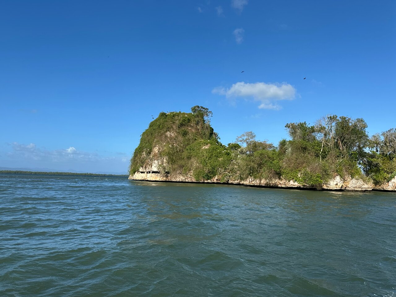
Some formations appear as steep coastal faces, while others rise as rounded hills known as mogotes. Along the water, sections of the limestone landscape may form rocky islands, vertical surfaces and cave entrances.
These features are connected by the same broad geological history.
The word cliff describes a steep rock face, while mogote refers to an isolated or rounded limestone hill. They are related landscape features, but they are not interchangeable terms.
2. How Was the Limestone Formed?
The geological history of Los Haitises goes back millions of years.
Scientific studies of eastern Hispaniola describe the Los Haitises Formation as part of a sequence of marine sedimentary deposits that developed during the Pliocene and Early Pleistocene.
The limestone formed largely in a shallow marine environment.
Marine sediments accumulated
In ancient coastal and shallow-water environments, carbonate material accumulated on the seabed.
This material included contributions from marine organisms such as corals, molluscs, echinoids and other carbonate-producing life.
Over time, layers of sediment built up.
Sediments became rock
As additional material accumulated, earlier deposits were buried and compacted.
Mineral processes helped bind the sediments into limestone.
The land emerged
Geological changes gradually raised parts of the region above sea level.
The emergence of these marine deposits helped create the landforms that now make up the Los Haitises region.
Scientific research on eastern Hispaniola identifies the Los Haitises Formation as part of a shallow-water marine platform that later emerged to form the region's present landscape.
This marine origin explains why limestone in the park is connected to ancient coastal and reef environments.
3. Why Does Limestone Erode Differently From Other Rocks?
Limestone is particularly vulnerable to chemical weathering.
Unlike rocks that mainly break apart through physical forces, limestone can slowly dissolve when exposed to slightly acidic water.
Rainwater absorbs carbon dioxide from the atmosphere and soil. This creates a weak carbonic acid solution.
When the water moves across limestone or enters cracks, it can gradually dissolve small amounts of the rock.
This process is called chemical weathering or limestone dissolution.
Over long periods, repeated dissolution can enlarge small cracks and create larger openings.
The process contributes to the formation of:
- Grooves and channels on exposed rock.
- Depressions in limestone surfaces.
- Underground cavities.
- Caves and passages.
- Irregular rock faces.
- Larger karst landscapes.
The geological surveys of the Los Haitises region describe extensive karst development, including dissolution depressions, mogotes and underground cave systems. <Cite refs={["turn131963search17","turn131963search18"]}/>
4. What Is Karst Erosion?
Karst is a type of landscape created mainly by the dissolution of soluble rocks, especially limestone.
Los Haitises is an important example of tropical karst scenery in the Dominican Republic.
The landscape includes both surface features and underground formations.
Surface karst
Surface karst features develop where water dissolves exposed limestone.
They may include:
- Rounded limestone hills.
- Depressions known as dolines.
- Irregular grooves and channels.
- Steep rock faces.
- Isolated limestone formations.
Underground karst
Water can also enter cracks and openings in limestone.
As dissolution continues, underground passages and caves may develop.
Some caves contain formations such as stalactites and stalagmites.
The karst landscape of Los Haitises is therefore not limited to what visitors can see above the water. Much of its geological character is also found beneath the surface.
5. How Natural Erosion Shapes the Coastal Rock Faces
The coastal formations of Los Haitises are influenced by several natural processes.
These processes operate over different timescales. Some act slowly over thousands of years, while others can affect exposed surfaces during individual storms.
Chemical weathering
Rainwater and groundwater gradually dissolve limestone.
This process can enlarge cracks and create irregular surfaces.
Wave action
Where rock faces are exposed to moving coastal water, waves can contribute to erosion.
Repeated water movement may wear away weaker sections and carry loose material away.
The amount of wave erosion depends on the location, exposure and local water conditions.
Rainfall
Rainwater runs over exposed rock surfaces and enters fractures.
Over time, this can contribute to dissolution and the development of small channels.
Physical weathering
Temperature changes, moisture and other environmental factors can contribute to the weakening of exposed rock.
Plant roots may also grow into existing cracks and contribute to the breakdown of rock material.
These processes work together, creating the varied shapes and surfaces visible across the park.
6. Why Are Some Limestone Formations So Steep?
The steep appearance of certain rock formations is related to their geological structure and the way erosion has affected the surrounding landscape.
Limestone does not dissolve uniformly everywhere.
Differences in fractures, rock structure and water movement can influence how quickly particular sections are weathered.
Over time, less resistant or more heavily dissolved areas may become lower, while stronger sections remain standing.
This uneven development helps produce the varied landscape of mogotes, rocky ridges and steep faces found in the Los Haitises region.
The result is a landscape with noticeable differences in height and shape, even across relatively short distances.
7. The Connection Between Limestone Cliffs and Mogotes
Mogotes are one of the most recognizable features of Los Haitises.
They are rounded or steep-sided limestone hills that rise above lower surrounding areas.
Although coastal cliffs and mogotes may look different, both are part of the region's broader karst landscape.
What creates a mogote?
Rainwater dissolves limestone over long periods.
As the surrounding rock is lowered or broken down through geological processes, more resistant sections can remain as elevated hills.
How are they different from cliffs?
A cliff is defined mainly by its steep face.
A mogote is defined by its hill-like shape and its role as an isolated limestone elevation.
A single geological region can contain both types of landform.
Why are they important?
Mogotes give Los Haitises its characteristic scenery.
They also help explain the relationship between the inland limestone landscape and the rocky formations found along the coast.
Visitors can often appreciate this connection by comparing the hills visible in the distance with the steep rock faces rising near the water.
8. Limestone Cliffs and the Caves of Los Haitises
Caves are another important part of the park's karst geology.
They form when water enters openings in soluble rock and gradually enlarges them.
In limestone, the process can create underground passages and chambers.
Over time, water dripping through cave ceilings may deposit calcium carbonate and create formations such as:
Stalactites: Mineral formations that hang from cave ceilings.
Stalagmites: Mineral formations that grow upward from cave floors.
Columns: Structures that develop when a stalactite and stalagmite eventually connect.
The geological relationship between cliffs and caves is especially interesting along exposed coastal limestone.
Rock faces may contain openings where underground cavities meet the surface.
However, not every visible opening is necessarily a cave entrance accessible to visitors.
Cave access depends on the specific site, authorization, safety arrangements and current park conditions.
9. How the Coastal Landscape Connects With San Lorenzo Bay
San Lorenzo Bay is one of the recognizable coastal settings associated with Los Haitises National Park.
The area combines limestone formations, mangrove vegetation and sheltered coastal waters.
The steep rock faces and small cays help create the bay's distinctive appearance.
During a guided boat excursion, visitors may notice:
- Limestone surfaces rising above the water.
- Vegetation growing on rocky formations.
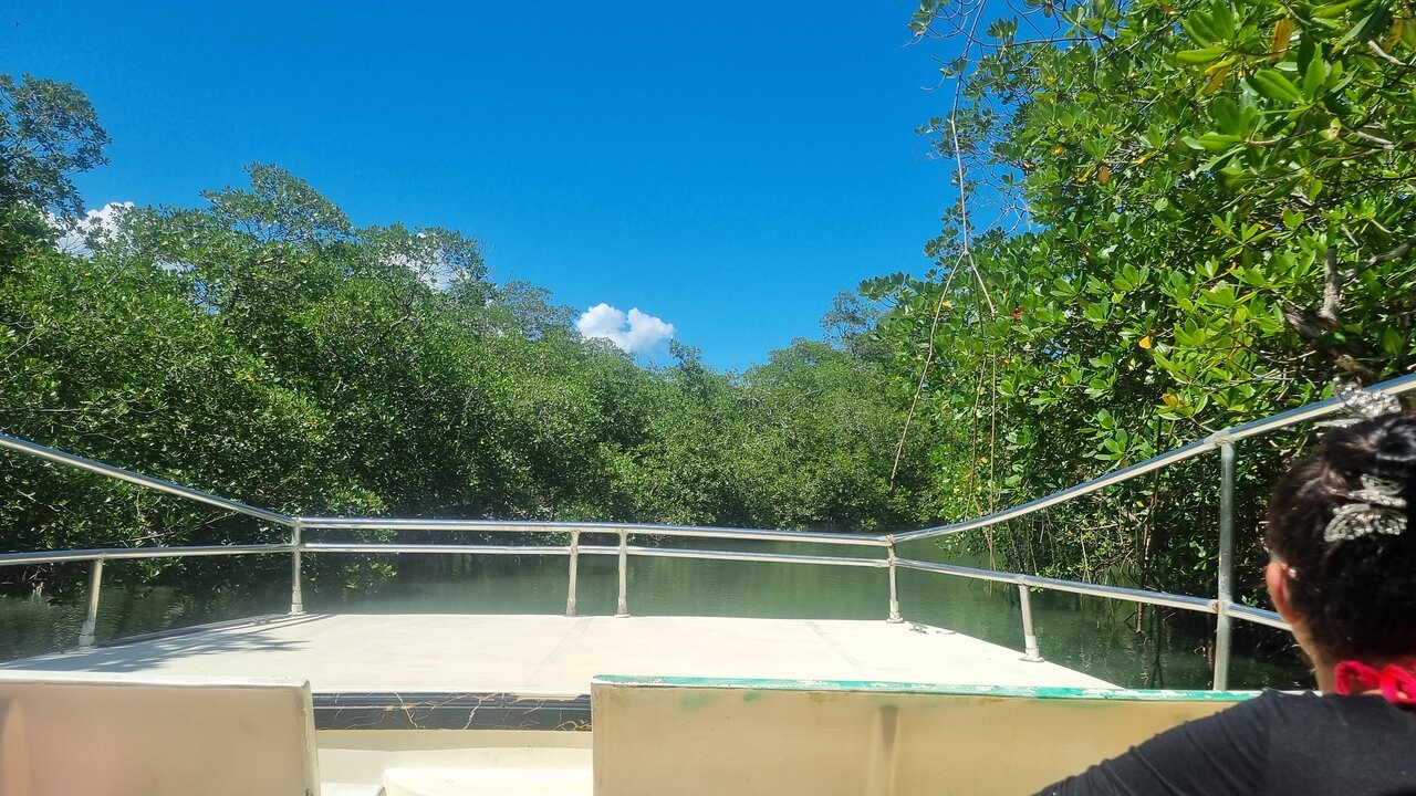
- Mangrove-lined sections of the coastline.
- Small islands and cays.
- Changes in the shape of the shoreline.
These features illustrate the relationship between geological processes and coastal ecosystems.
The bay is not simply a scenic body of water. It is part of a wider landscape shaped by the interaction of limestone, water and vegetation.
10. How Mangroves Interact With the Limestone Coast
Mangroves are another defining feature of Los Haitises.
They grow in suitable coastal environments where water movement, salinity, sediment and other conditions support their development.
In some areas, mangrove vegetation occurs near limestone formations.
This creates a striking contrast between hard rocky surfaces and the complex root systems of coastal trees.
Mangrove roots and sediment
Mangrove roots can slow water movement and help trap sediment.
This contributes to the development and stability of suitable coastal habitats.
Habitat connections
The nearby waters and mangroves support a variety of organisms.
Fish and invertebrates may use mangrove roots for shelter, while birds use the wider coastal environment for feeding and resting.
A varied landscape
The combination of limestone, mangroves and water creates the distinctive coastal scenery of Los Haitises.
Visitors should avoid assuming that every limestone formation supports mangroves. The vegetation depends on local environmental conditions.
11. Can Visitors See the Limestone Cliffs by Boat?
A guided boat excursion is a practical way to observe many of the park's coastal formations.
From the water, visitors can appreciate the height, shape and surface texture of the exposed limestone.
Depending on the route, the excursion may also include views of mangroves, small cays and selected caves.
Before booking, ask the operator:
- Does the route include San Lorenzo Bay?
- Which coastal rock formations are included?
- Are caves part of the itinerary?
- How much time is available for sightseeing?
- Is the excursion guided?
- Are all advertised stops currently accessible?
Not every excursion follows the same route, and access to individual sites can change.
Do not assume that all cliffs or caves can be approached by boat or visited on foot.
12. Best Photography Tips for Limestone Formations
The limestone formations of Los Haitises provide excellent opportunities for landscape photography.
Their steep surfaces, irregular shapes and surrounding vegetation create interesting compositions.
Photograph from different angles
A boat journey can provide changing views of the rock formations.
Photograph the same formation from different distances to capture both its overall shape and surface details.
Include vegetation
Green vegetation growing on limestone creates a strong visual contrast.
Including both rock and plants can help communicate the character of the landscape.
Look for natural textures
Limestone surfaces may contain cracks, grooves and irregular patterns.
Use close-up photographs where it is safe and permitted to do so.
Capture the wider setting
Include water, mangroves and distant formations to show how the cliffs fit into the wider park landscape.
Protect your equipment
Use a waterproof bag or camera cover during boat excursions.
Keep equipment secure when moving around the boat and follow crew instructions.
13. Are Limestone Cliffs Dangerous?
Limestone cliffs are natural geological features and should be approached with caution.
Their surfaces may be uneven, fractured, slippery or unstable.
Even formations that look solid from a distance may contain loose sections or hidden cracks.
Visitors should:
- Stay on authorized paths.
- Avoid climbing exposed rock faces.
- Never stand beneath unstable overhangs.
- Follow guide instructions.
- Avoid entering caves without permission.
- Keep a safe distance from steep edges.
- Avoid touching or damaging fragile formations.
A boat-based visit can offer excellent views without requiring visitors to climb or walk on the rock formations.
14. How Climate and Rainfall Influence Limestone Erosion
Los Haitises receives substantial rainfall, which contributes to the development of its karst landscape.
Water is central to limestone dissolution.
When rainwater enters the soil, it can absorb carbon dioxide and become mildly acidic.
As this water moves through limestone, it slowly dissolves the rock.
The effect is gradual, but over long geological periods it can produce major changes.
Rainfall also influences vegetation and the movement of water through the park.
The interaction between water, limestone and tropical vegetation helps explain why Los Haitises has such a distinctive landscape.
It is important to remember that geological change usually occurs over timescales much longer than a visitor's lifetime. The formations are not visibly changing from day to day.
15. Why the Limestone Formations Matter for Conservation
The limestone formations are part of the park's natural heritage.
They are connected to the caves, hills, coastal islands and habitats that make Los Haitises important.
Protecting them requires responsible visitor behavior.
Avoid damaging rock surfaces
Do not scratch, carve or write on limestone.
Even small marks can damage natural and archaeological features.
Do not remove stones or fossils
Leave geological materials where they are.
Removing natural objects can affect the site and its scientific value.
Respect cave restrictions
Some caves contain delicate geological formations and cultural features.
Follow the rules for each authorized visitor area.
Prevent pollution
Do not leave rubbish or dispose of waste in waterways.
Use responsible guides
Choose operators who respect park regulations and explain the importance of protecting the landscape.
16. What Makes the Limestone Cliffs Worth Seeing?
The limestone cliffs are a visual expression of the geological history of Los Haitises.
They show how ancient marine deposits became rock and how natural processes gradually shaped that rock into a complex landscape.
Their importance becomes even clearer when viewed alongside the park's other features:
- Mogotes and rounded limestone hills.
- Caves and underground passages.
- Coastal cays and rocky islands.
- Mangrove forests.
- Sheltered bays and waterways.
For travelers, the formations create a dramatic setting for boat excursions and nature photography.
For anyone interested in geology, they offer an opportunity to understand how the landscape of the Dominican Republic developed over millions of years.
Frequently Asked Questions
What are the limestone cliffs of Los Haitises made of?
They are part of the region's limestone formations, which developed from carbonate sediments deposited in ancient marine environments.
How old are the limestone formations?
Scientific studies describe the Los Haitises Formation as Pliocene to Early Pleistocene in age. The exact age varies across the wider geological sequence and should not be assigned to every visible rock surface individually.
Why does limestone erode?
Limestone dissolves slowly when exposed to slightly acidic water. Rainwater and groundwater can enter cracks and gradually enlarge them.
What is karst erosion?
Karst erosion is the process through which soluble rocks, especially limestone, are dissolved by water. It creates features such as caves, depressions, grooves and distinctive hills.
Are the cliffs and mogotes the same thing?
No. A cliff is a steep rock face, while a mogote is a rounded or isolated limestone hill. Both can occur within the same karst landscape.
Are there caves inside the limestone formations?
Yes. Los Haitises has a developed karst cave system. However, visitor access to individual caves depends on current authorization and safety conditions.
Can visitors climb the limestone cliffs?
Visitors should not climb formations unless a specific activity and route are officially authorized. Uneven and fractured rock can be dangerous.
Where can I see the limestone formations?
They can be observed in different parts of Los Haitises, including coastal areas explored on suitable guided boat excursions. Confirm the route with your tour operator.
Are the limestone formations still changing?
Yes. Natural weathering and erosion continue, but most changes occur very slowly over long periods.
What is the best way to photograph the cliffs?
A boat excursion provides changing viewpoints of the rock faces and surrounding landscape. Protect your camera from water and follow the crew's safety instructions.
Final Thoughts
The limestone cliffs of Los Haitises National Park are part of a remarkable geological landscape shaped by ancient marine environments and long periods of natural erosion.
Their steep surfaces, caves, mogotes and coastal formations reveal the influence of water on limestone over geological time.
For visitors, these rock formations add dramatic scenery to a park already known for its mangroves, wildlife and waterways.
The next time you travel through Los Haitises, look closely at the shape of the limestone. The cliffs are not simply beautiful coastal scenery. They are evidence of a geological history that continues to influence the landscape today.
Explore them responsibly, follow authorized routes and help protect the natural formations that make Los Haitises one of the Dominican Republic's most distinctive national parks.
Local explorer & expert guide in El Limón Waterfall.